Application Description
Uncover Mexico's geological wonders with GeoInfoMex, the definitive geological consultation app. Explore the rich subsurface world at your fingertips, accessing a wealth of geoscientific data. Discover invaluable resources including geological-mining and geophysical data, geochemical maps, and detailed information on mines, beneficiation plants, and significant rock formations. Gain insights into land ownership via the National Agrarian Registry's data on agrarian nuclei (ejidos). Appreciate the beauty of Mexico's natural heritage with information on CONANP protected natural areas. Stay informed about seismic activity with real-time earthquake updates from SSN and IG-UNAM. Furthermore, access hydrological data from Cencas, providing comprehensive insights into Mexico's water resources. GeoInfoMex is your key to an unparalleled geological adventure.
Features of GeoInfoMex:
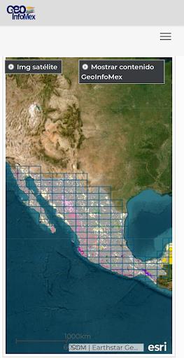
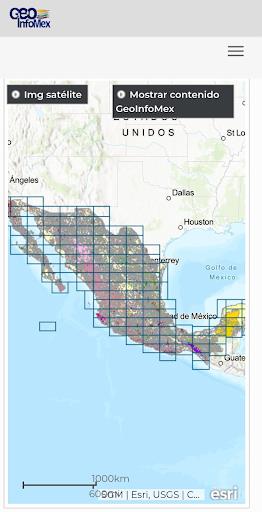
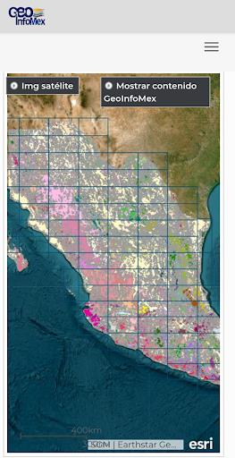
- Comprehensive Geological Information: GeoInfoMex offers extensive geoscientific, geological-mining, and geophysical data on Mexico. Access detailed maps and data related to geological-mining activities, geophysical surveys, and geochemical mapping.
- Mining and Rock Data: The app provides valuable information on mines, beneficiation plants, and notable rock formations across Mexico. Explore locations, characteristics, and other relevant details of mining operations and significant geological features.
- Land Ownership Details: GeoInfoMex integrates data from the National Agrarian Registry, providing information on agrarian nuclei (ejidos), including land ownership, boundaries, and related details.
- Protected Natural Areas: Access information on protected natural areas managed by CONANP (National Commission of Natural Protected Areas). Ideal for eco-tourism enthusiasts and conservationists alike.
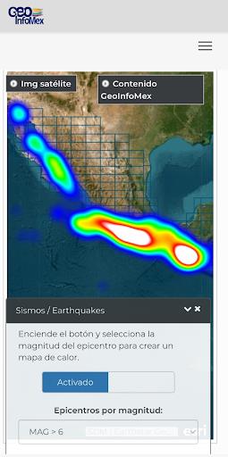
- Earthquake Monitoring: Stay informed with real-time earthquake data from the National Seismic Service (SSN) and the Institute of Geophysics at UNAM (IG-UNAM), including magnitude and location.
- Hydrological Data: Explore hydrological data from Cencas (presumably a division of the National Water Commission, CNA), including water resources, river basins, and water quality information.
Conclusion:
Whether you're a geoscientist, researcher, environmentalist, or simply fascinated by Mexico's geology, GeoInfoMex is your essential resource. Download now and embark on a journey to discover Mexico's captivating geological landscape!
Screenshot
Reviews
An excellent tool for anyone interested in geology. The data is detailed and accurate, making it perfect for both students and professionals.
メキシコの地質情報を簡単に閲覧できるアプリです。データが非常に詳細で、とても役立ちます。初心者にもおすすめです。
메스칼리테의 지질학적 경이를 발견하세요. 과학적인 데이터가 풍부하여 전문가와 학생 모두에게 유용합니다.
Apps like GeoInfoMex


Trending apps


Top News

![Roblox Forsaken Characters Tier List [UPDATED] (2025)](https://images.dyk8.com/uploads/18/17380116246797f3e8a8a39.jpg)


Latest Apps


Latest Articles